 Geographical Map : District Detail
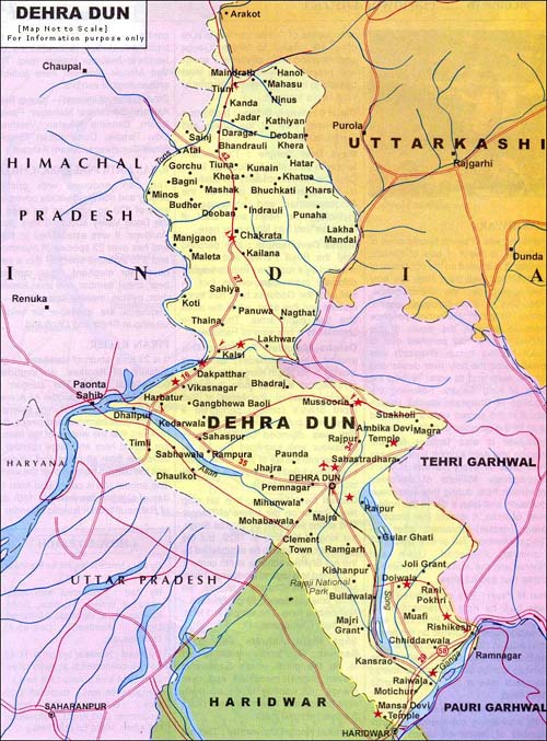
| DEHRADUN |
|
The capital city of Uttarakhand is a complete blend of city and hill
culture. It is set in the foot hills of Himalayas at the centre of the
120 kms long Doon Valley. The name Dehradun is literally made up of two
words where Dera means Camp and Dun stands for Valley. The beautiful
town is referred as the gateway to Mussoorie and Garhwal interior. It is
perhaps one of the oldest cities in India and was occupied in turns by
the Sikhs, Mughals and Gurkhas before coming under the reigns of the
British. Elite educational and other institutions were established
during the British period.
Area: 300 sq km
Total Population: 4,47,808
Literacy: 77%
|
 |
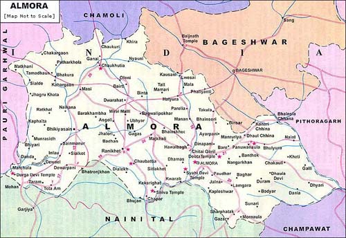
| ALMORA |
|
Almora is endowed with exceptional natural beauty and rich cultural
heritage, exquisite handicrafts, delectable cuisine and exotic wildlife.
This charming hill resort was the flourishing capital of the Chand
dynasty. The region was earlier under the reigns of the Katyuri king
Baichaldeo, who donated this area to a Gujarati Brahmin Sri Chand
Tiwari. In 1560 the capital of Chand Dynasty was shifted to Almora (from
Champawat) by Kalyan Chand. The beautiful town is set on a 6 kms long
horse saddle shaped ridge. It affords breathtaking views of the snowy
summits of Himalayas and is an excellent place for a peaceful holiday.
District Headquarters: Almora
Area: 3090 sq km
Total Population: 630,567
Literacy : 74.53%
|
 |
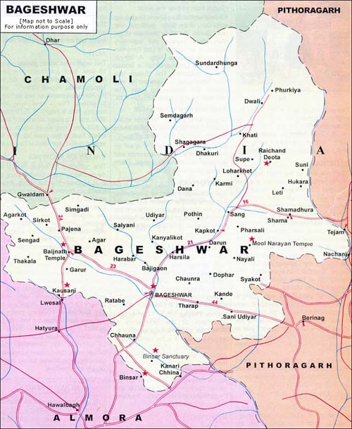
| Bageshwar |
|
Bageshwar, the 'Abode of Gods' is an important pilgrim and tourist
centre. It is located about 90 kms from Almora on the confluence of the
rivers Saryu and Gomti. The town is famous for ancient Bagnath Temple
and the annual Uttaraini fair held in January.
The beautiful town is also a delight for adventure sports lovers. The
famous Pindari, Sunderdunga and Kafni glaciers can be reached via
Bageshwar.
Bageshwar gets its name form this ancient temple of Lord Shiva set in
the heart of the town. According to mythological legends, sage Markandey
lived here and the place was visited by Lord Shiva in the form of Bagh
or tiger.
District Headquarters: Bageshwar
Area: 2310 sq km
Total Population: 241,659
Literacy: 71.94% |
 |
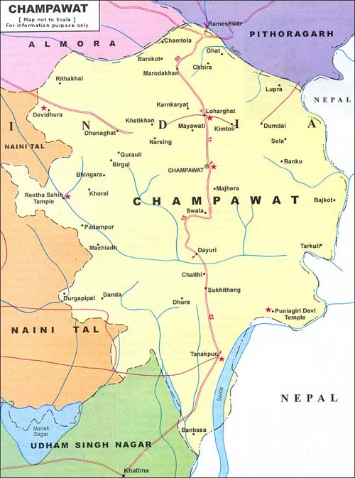
| Champawat |
|
Champawat, the ancient capital of the Chand rulers is well known for its
temples and natural beauty. The historical town 76 kms from Pithoragarh
has an ancient fort, which is now headquarters of the Tehsil office.
The mythological legends suggest that Lord Vishnu appeared here as
'Kurma avatar' (the tortoise incarnation). The story of Golla Devta is
also associated with Gorilla Chaur of Champawat. Jim Corbett, the famous
hunter came to this region in the first decade of the 20th century to
hunt for man eating tigers. His first book, "Man Eaters of Kumaon" is
related to Champawat.
Champawat was declared as a separate district on 15 Dec. 1997 by then CM
of UP Ms. Mayawati, then it was a part of UP. Earlier Champawat was
only a Tehsil of Pithoragarh district.
District Headquarters: Champawat
Area: 1781 sq km
Total Population: 224,542
Literacy: 71.11%
|
 |
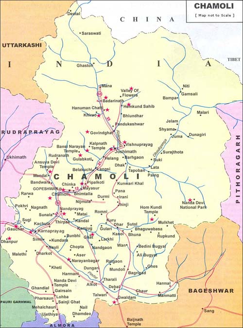
| Chamoli |
|
The enchanting land in the lap of the majestic Himalayas seems to be
especially blessed by the mother nature. The district is studded with
major pilgrim centres like Badrinath, Joshimath, Tungnath and Hemkund
Sahib, snow-clad peaks and exceptional natural beauty.
District Headquarters: Gopeshwar
Area: 7951 sq km
Total Population: 370,359
Literacy: 76.23.%
|
 |
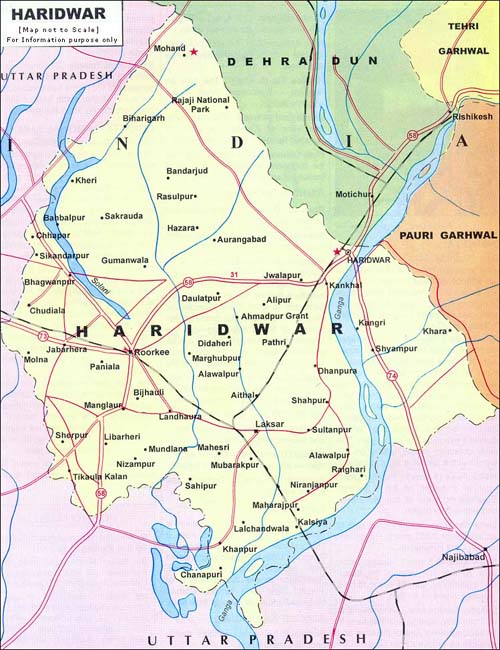
| Haridwar |
|
Haridwar is located on the right bank of river Ganga and from here the
holy river spreads over the northern plains. According to a mythological
legend, Prince Bhagirath performed penance here to salvage the souls of
his ancestors who had perished due to Saint Kapila's curse. Bhagirath
was blessed and the holy river descended on the earth and its water
revived the sons of King Sagara. Following the tradition of Bhagirath,
devout Hindus stand in the sacred waters here, and pray for the
salvation of their ancestors.
Haridwar is also famous for the Kumbh and Ardh Kumbh fairs that are held
once in every 12 and 6 years respectively. Millions of devotees
assemble here during this auspicious occasion and take a dip in the
holiest river of India. It is said that drops of amrit (nectar) obtained
after the 'Sagar Manthan' fell at four places Haridwar, Allahabad,
Ujjain and Nashik and the Kumbh fair is held at these four sacred sites.
District Headquarters: Haridwar
Area: 2360 sq km
Total Population: 14,47,187
Literacy: 64.60%
|
 |
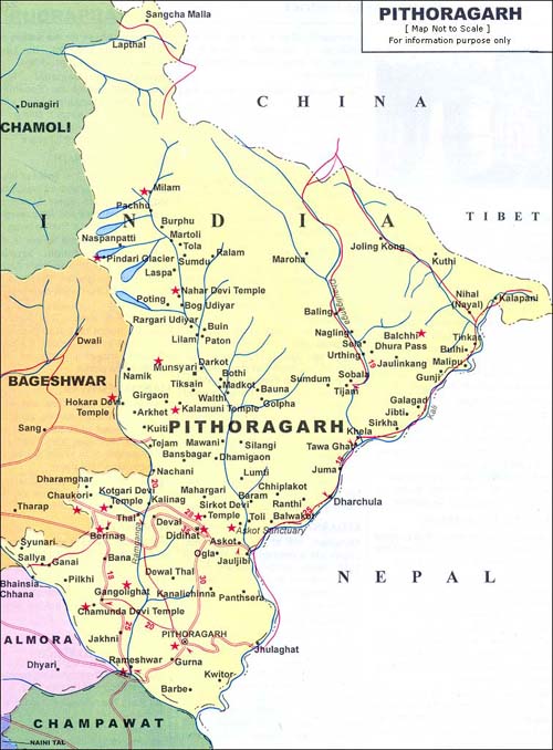
| Pithoragarh |
|
Picturesque Pithoragarh town is delight for mountaineers, trekkers,
adventure seekers, botanists, pilgrims as well as sightseers. It is an
important halt on the famous Kailash Mansarovar Yatra route. The rivers
originating from the Pithoragarh mountains are perfect for water sports,
while the lush jungles here teem with rich variety of flora and fauna.
District Headquarters: Pithoragarh
Area: 7110 sq km
Total Population: 462,289
Literacy: 76.48%
|
 |
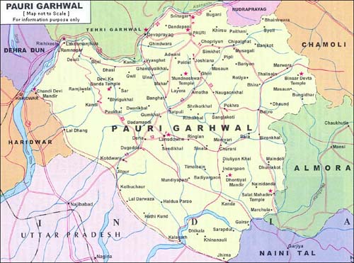
| Pauri |
|
Panoramic Pauri is perched at an altitude of 1814 metres on the northern
slopes of Kandoliya hills. The peaceful resort affords a fine view of
the snowy Himalayan peaks.
District Headquarters: Pauri
Area: 5438 sq km
Total Population: 697,078
Literacy: 77.99%
|
 |
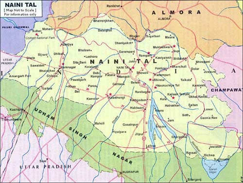
| Nainital |
|
Nainital - The beautiful lake resort nestles amidst seven hills in a
lush valley at an altitude of 1938 metres. In 1841, the British first
discovered Nainital as a holiday resort. Today, the town has emerged as
one of the most important hill resorts of India.
District Headquarters: Nainital
Area: 3853 sq km
Total Population: 762,909
Literacy: 79.60%
|
 |
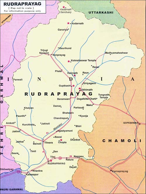
| Rudraprayag |
|
Rudraprayag - A small pilgrim town on the holy confluence of river
Alaknanda and Mandakini which is venerated as one of the five sacred
confluences or the 'Panch Prayag'.
Rudraprayag It is named after Rudra, an aspect of Lord Shiva. According
to a legend Lord Shiva appeared here as 'Rudra' to bless Narad Muni. An
ancient shrine is dedicated to Lord Shiva in the form of 'Rudra'.
Rudraprayag is of immense significance for the pilgrims of Char Dham
Yatra, as it is the junction for visiting Badrinath and Kedarnath Dham.
District Headquarters: Rudraprayag
Area: 1896 sq km
Total Population: 227,439
Literacy: 74.23%
|
 |
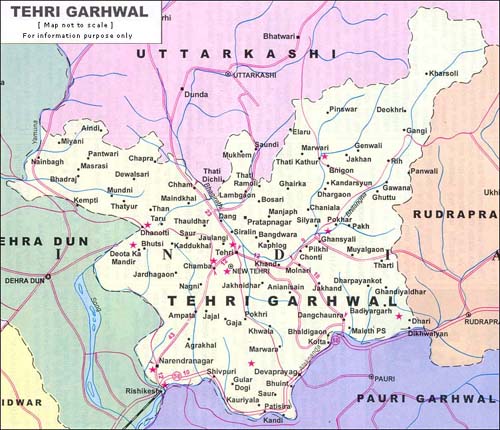
| Tehri |
|
New Tehri - The newly built well planned modern town nestles at a height
of 1,550 metres overlooking the massive artificial lake and Tehri dam
built on the Bhagirathi and Bhilangana river. It has taken over as
district headquarters of Tehri Garhwal from the Old Tehri town and was
established to rehabilitate the Old Tehri, which will be submerged into
the waters of the Tehri Dam. In fact New Tehri is considered to be
Asia's most comprehensive and successful rehabilitation programme. The
gleaming township has developed into a lovely hill resort.
District Headquarters: New Tehri
Area: 4085 sq km
Total Population: 604,747
Literacy: 67.04%
|
 |
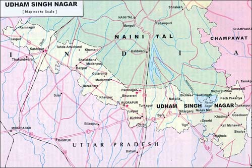
| Udham Singh Nagar |
|
Udham Singh Nagar district was carved out of Nainital district in
October 1995 and was named after Saheed Udham Singh, a great freedom
fighter, who killed General Dyer and took revenge for the Jalianwala
Bagh massacre. The district is also called as the 'Gateway to Kumaon
hills'. There are three main sub-divisions - Rudrapur, Kashipur and
Khatima; four tehsils Kashipur, Kichha, Khatima, Sitarganj and two
sub-tehsils - Bajpur and Gadarpur.
District Headquarters: Rudrapur
Area: 2912 sq km
Total Population: 12,35,614
Literacy: 65.76%
|
 |
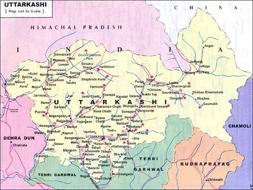
| Uttarkashi |
|
he holy town of Uttarkashi is set on the banks of river Bhagirathi at an
altitude of 1158 metres, about 145 kms from Rishikesh on the main route
to Gangotri. It is considered to have similar religious importance as
Kashi. The famous Vishwanath temple here is dedicated to Lord Shiva. In
front of the temple is unique Mahadev-ka-Vishal Trishul or Shiva's Great
Trident, made of eight major metals. It is believed Lord Shiva killed
Vakasur with this trident. Other important temples are dedicated to Lord
Parashuram, Lord Ekadash Rudra and Goddess Kali.
District Headquarters: Uttarkashi
Area: 7951 sq km
Total Population: 295,013
Literacy: 66.58%
|
 |
|
|
|